
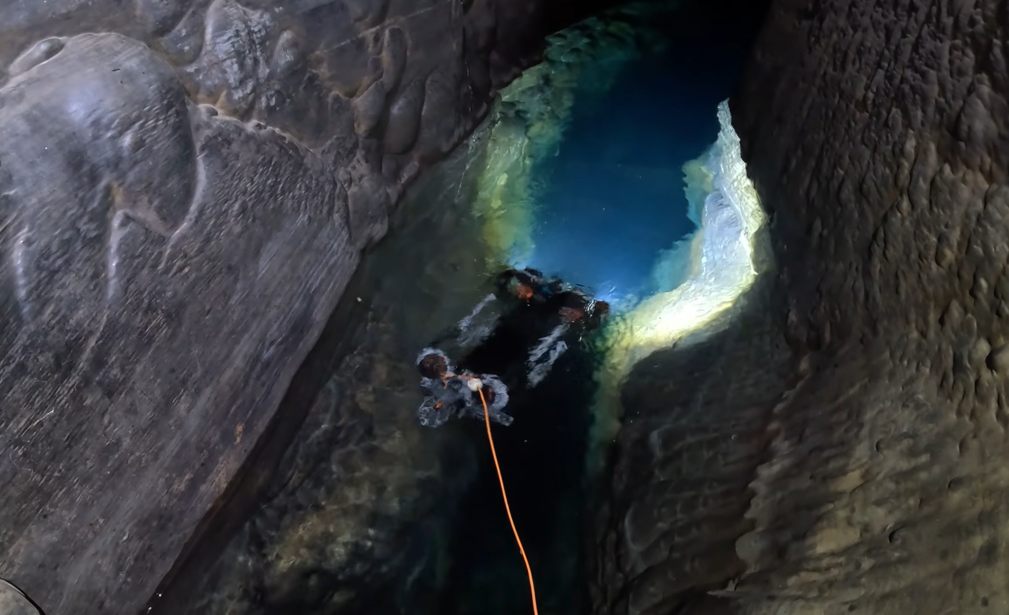
CHASING M2 PRO MAX explores the confined thermal lake inside Raja Santa Cave, extending underwater observation beyond areas that are difficult for people to access directly.
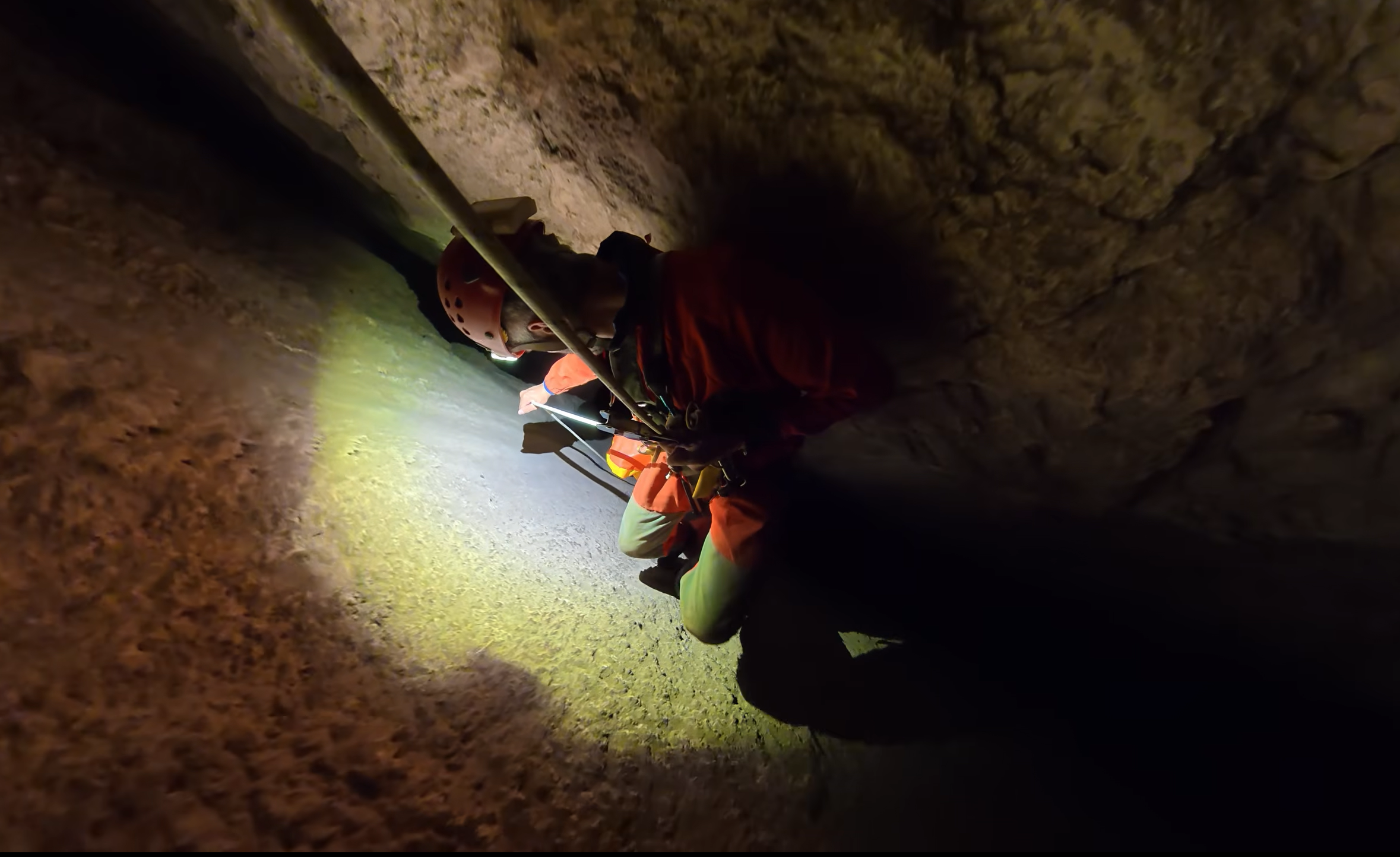
Expedition members move through a confined section of Raja Santa Cave while transporting the CHASING M2 PRO MAX toward the thermal lake approximately 120 meters underground.
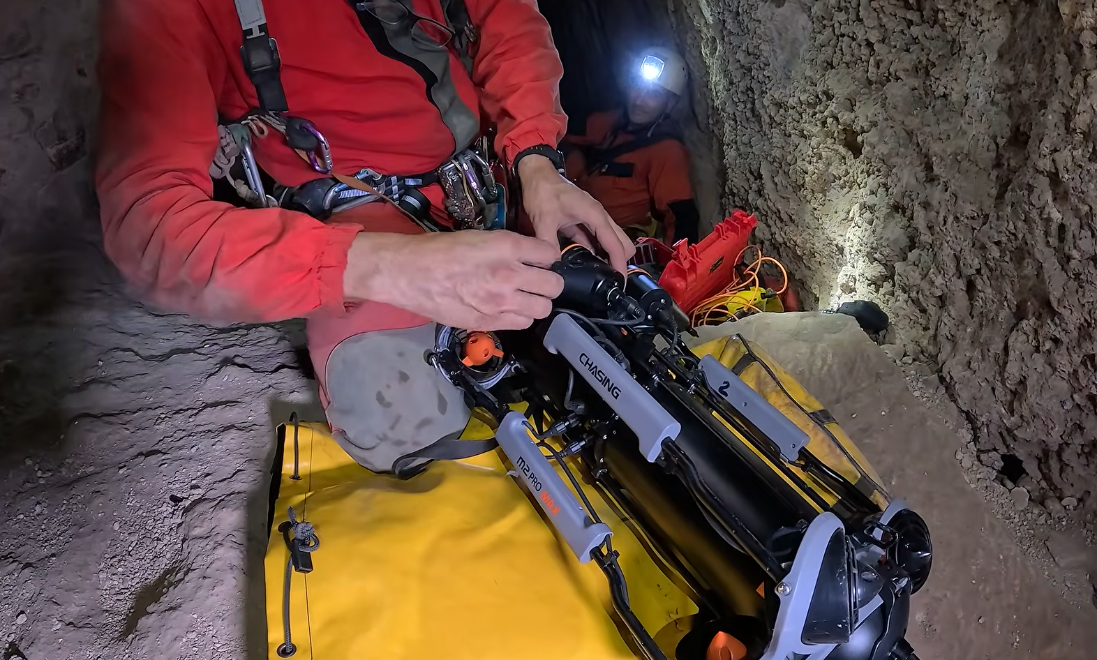
The expedition team prepares the CHASING M2 PRO MAX after transporting the underwater ROV through the cave to the underground exploration site.
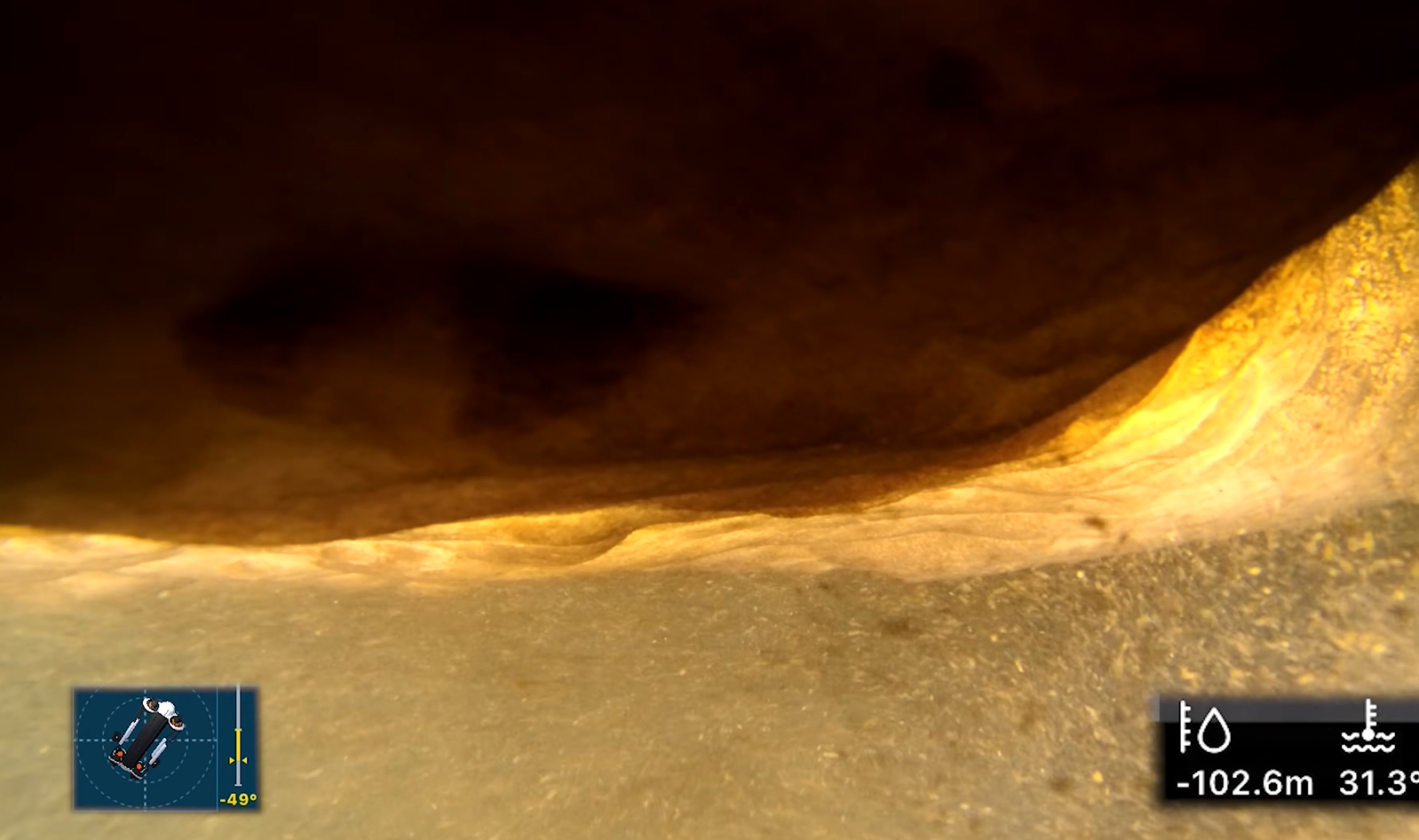
CHASING M2 PRO MAX reaches a depth of 102.6 meters in Raja Santa’s thermal lake, recording the confined rock formations at the deepest point of the exploration.
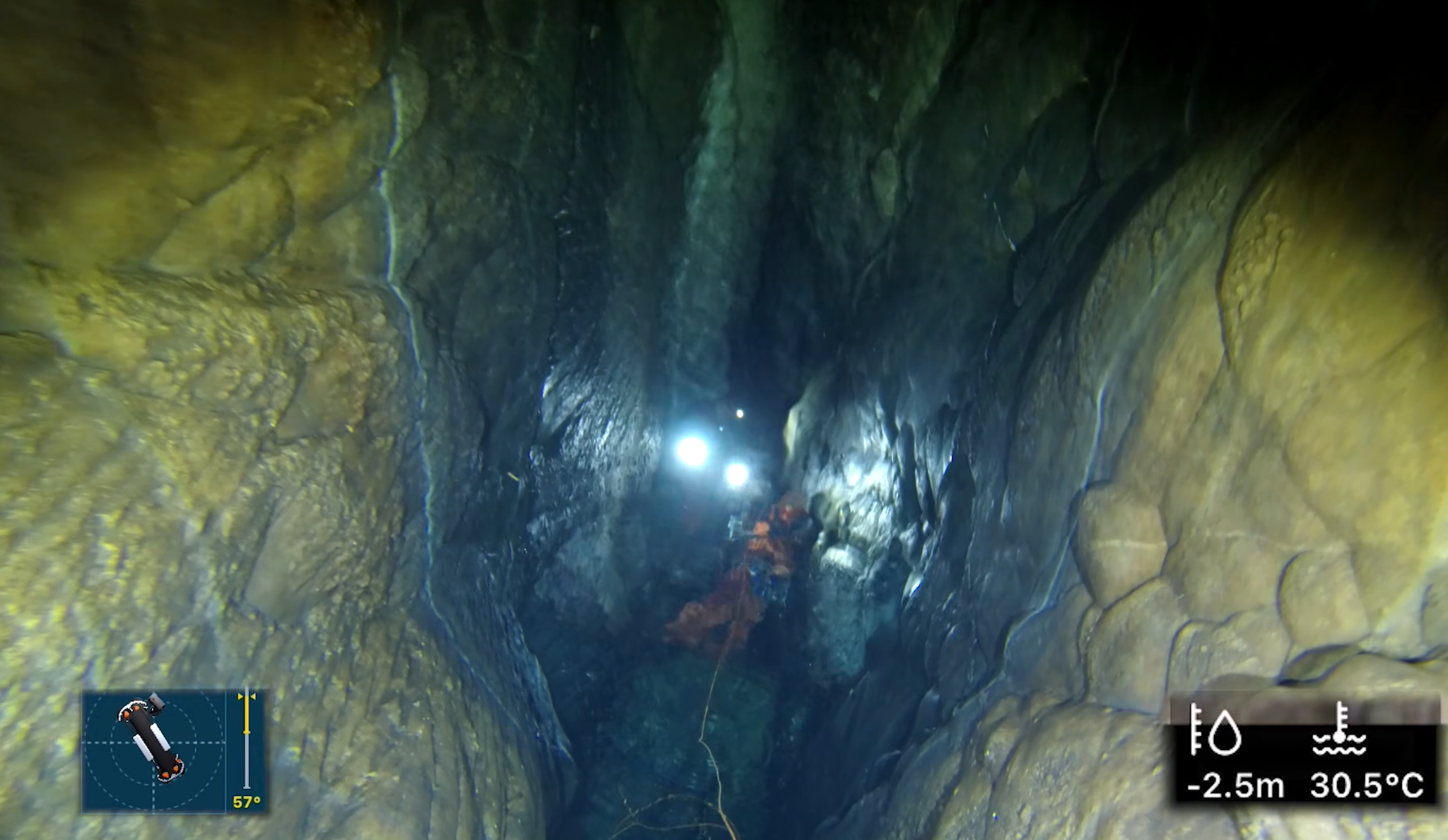
CHASING M2 PRO MAX is recovered after completing its underwater exploration mission inside Raja Santa Cave.
75 years later, 3D LiDAR and CHASING M2 PRO MAX extend Raja Santa exploration to 222.6 meters, supporting future fault studies.
GRANADA, GRANADA, SPAIN, September 21, 2026 /EINPresswire.com/ -- A new expedition to Sima de Raja Santa in Atarfe, Granada, Spain, has extended underwater exploration of the cave’s thermal lake to a depth of 102.6 meters using a CHASING M2 PRO MAX underwater ROV.
The lake lies approximately 120 meters below
the cave entrance. Combined with the underwater descent, the expedition documented a total vertical depth of approximately 222.6 meters from the entrance.Coordinated by speleologist Antonio Moreno and involving members of several Andalusian caving groups, the project combined 3D LiDAR scanning above the water with robotic exploration below it. LiDAR was used to map the accessible dry sections of the cave, while CHASING M2 PRO MAX continued the investigation beneath the thermal lake.
More than seven decades after the first documented explorations of Raja Santa, the expedition extended observation substantially beyond previous underwater surveys. Earlier documented dives had reached approximately 43 meters below the lake surface. In 2026, the underwater ROV continued beyond that point and reached 102.6 meters before the geological fracture became too narrow to proceed further.
The project also has value beyond cave exploration. Raja Santa is associated with the tectonically active Atarfe area. By combining 3D mapping with underwater observation, the team created a digital record that can serve as a baseline for future geological study and comparison of changes within the underground environment.
Underwater Exploration Begins 120 Meters Below Ground
Before the underwater mission could begin, the team first had to transport the ROV, LiDAR equipment, ropes and other gear through the cave.
They moved through narrow passages, irregular rock formations and vertical sections before reaching the thermal lake approximately 120 meters underground.
This made portability and maneuverability particularly important. The compact CHASING M2 PRO MAX could be transported with the expedition equipment and deployed from the limited working area beside the lake.
Once underwater, its eight vectored thrusters provided omnidirectional maneuverability, enabling the operator to move forward and backward, rise and descend, and make lateral adjustments while navigating rock formations and narrowing passages.
As the ROV descended, the environment became increasingly confined. Between approximately 60 and 90 meters, it navigated around large rock formations and through tighter sections. Near the deepest part of the dive, disturbed sediment reduced visibility, while the narrowing fracture left progressively less room to maneuver.
The ROV continued recording the submerged environment until it reached 102.6 meters below the lake surface, where the passage became too narrow to continue.
Water temperatures recorded during the exploration ranged from approximately 30.7°C to 31.3°C.
Extending Observation Into Previously Unexplored Areas
Reaching 102.6 meters was more than a depth milestone.
CHASING M2 PRO MAX recorded underwater imagery of rock formations, fractures, sediment and passage conditions beyond the limits reached in previous documented dives at the site.
This information gives exploration teams an initial view of what lies ahead before deciding whether further diving, mapping or scientific investigation is practical.
At Raja Santa, 3D LiDAR documented the cave above the waterline, while the underwater ROV extended observation into the flooded section below. Together, the two technologies created a more complete digital record of the underground environment.
“We returned with new technology to reveal its secrets,” Moreno said in the expedition documentary.
The resulting imagery and mapping can be reviewed after the expedition and used to support future mission planning and continued study of the cave and its geological setting.
A Digital Reference for Future Geological Studies
In September 2026, Spanish national television network Telecinco reported on the Raja Santa project in the context of the Atarfe fault area and recent seismic activity in Granada, highlighting both the 3D mapping work and the underwater exploration of the thermal lake.
The digital model provides a reference point for future research. If the cave is surveyed again following future seismic activity or other geological changes, researchers may be able to compare new observations with the current dataset and identify observable structural changes within the cave environment.
CHASING M2 PRO MAX extended that digital record into submerged areas beyond the limits of previous documented dives, reaching 102.6 meters below the lake surface.
The role of the underwater ROV in this project was not simply to reach greater depth, but to extend direct observation and documentation into submerged areas that are difficult and potentially hazardous to access using conventional methods.
More than seven decades after the first explorations of Raja Santa, the expedition demonstrates how 3D LiDAR and underwater robotics can transform difficult-to-access geological environments into digital records that can be revisited, analyzed and compared over time—supporting future exploration, geological research and a deeper understanding of tectonically active environments.
Source Materials: Project information, expedition video and on-site footage provided by expedition coordinator Antonio Moreno and participating Andalusian caving teams.
About CHASING
Founded in 2016, CHASING develops and manufactures underwater robots and underwater imaging technologies. Its products are used in more than 100 countries and regions across public safety, underwater inspection, maritime operations, scientific research, aquaculture and underwater exploration.
CHASING develops compact and professional underwater robotic platforms designed to help users access, observe and document complex, confined and difficult-to-reach underwater environments.

No comments:
Post a Comment